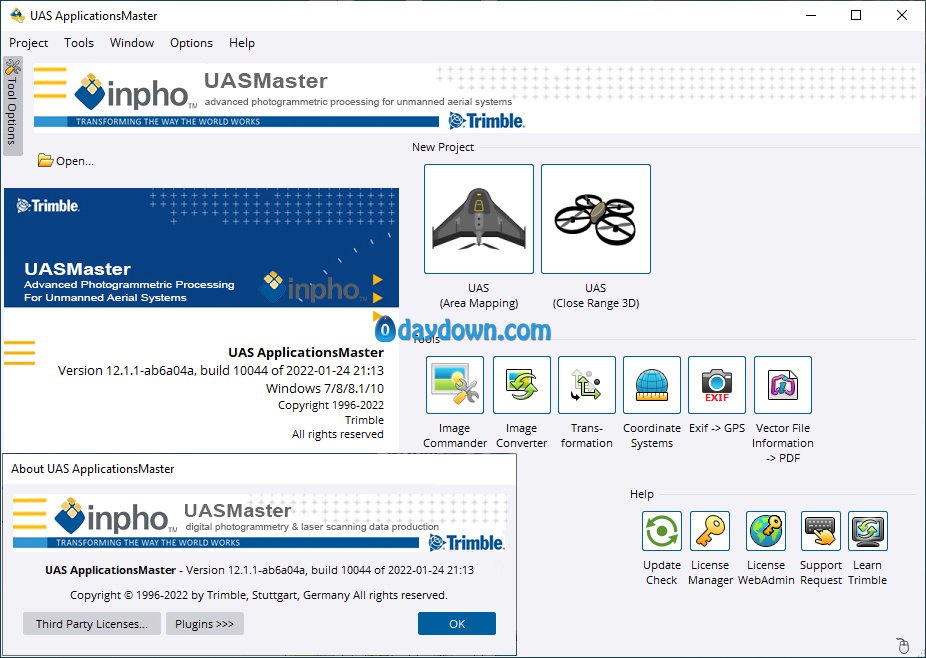
The Trimble Geospatial development team is pleased to announce the availability of Inpho UASMaster 12.1.1 is combines ease of use with the full power of a photogrammetric workstation and bridges the gap between simple near black-box workflows for non-photogrammetrists and photogrammetry expert workflows.
What’s New in Trimble Inpho Version 12
Trimble Inpho version 12 (v12.0, September 2021; v12.1, December 2021; v12.2, March 2022) is available for all Inpho software products, including UASMaster.
To meet the evolving needs of the aerial imagery market, version 12 of the Inpho software is focused on increased productivity and generation of higher quality deliverables. A new image matching engine in MATCH-AT has stronger tie point extraction capabilities, and there are also improved production engines in MATCH-3DX and UASMaster. Inpho users will observe enhanced performance and increases in the quality of block geometry. They will also be able to create final deliverables for imagery projects ranging from UAV to large and high-overlap aerial platforms.
High quality and efficiency products in UASMaster
True-orthophotos in this version can be generated in full resolution quality. The overall mosaics are with more homogeneity and balanced radiometry. The new version of UASMaster delivers a cleaned-up final mosaic by automatically generating a borderline, if not pre-defined. Furthermore, the quality of true orthophotos of highly distorted images is increased, by selecting the best part of the image in orthophoto generation.
UASMaster version 12 offers higher quality in 3D meshes with more sharpness on the edges, as well as enhanced texture on the model. Furthermore, the reduction of triangles in the multi-resolution geometry helps to produce more efficient 3D models for better streaming and optimized data storage.
Higher quality in dense matching based on SGM
In the most recent version, users can benefit from a new deliverable based on Semi Global Matching (SGM) and enjoy 3D and 2.5D dense point cloud, true-orthophotos and 3D meshes with highest quality in pixel level.
This level of quality in dense matching is very important for feature extraction applications based on true orthophotos, measurement and mapping applications based on point clouds, and 3D representation of the object based on 3D meshes with higher accuracy.
Much faster production based on SGM
The overall and combined delivery of the end products (dense point cloud, true-orthophotos, 3D meshes) based on Semi Global Matching (SGM) can reach up to 2x faster speed. For the default scenario, the significantly highest performance can be seen in the generation of 3D meshes (up to 5-7x) and texturing the meshes (up to 3-5x).
For the other products, the SGM engine can speed up your productivity in the generation of dense point clouds (up to 25%), DSM (up to 5-10%). These numbers can vary depending on the image compression and the project types (nadir, oblique).
Integration of Trimble Coordinate System
Considering the worldwide coverage of Trimble Coordinate System (TCS) with various projection and geoid, Trimble Inpho and UASMaster workflows are now empowered by TCS. As this coordinate system has been used in many hardware and software within Trimble, this integration supports our users, not only to enjoy this comprehensive coordinate system but also better handle the data within Trimble ecosystem. We highly encourage our customers to use TCS for their projects. However, for the transition time to replace the Inpho Coordinate System (ICS) with TCS, and collecting your feedback e.g., any compatibility purposes for the older projects or your wishes on completeness of TCS, we will keep the Inpho Coordinate System (ICS) in version 12.
Trimble Inpho software is designed to precisely transform raw aerial and satellite images into consistent and accurate point clouds and surface models, orthophoto mosaics and digitized 3D features using state-of-the-art photogrammetry techniques. These essential processes standardize and enhance geospatial data for national mapping, forestry, agriculture, mining, utility and energy, urban development, defense and disaster response geo-information workflows.
Trimble Inpho UASMaster is the perfect tool for complete data processing with unmanned aerial vehicle (UAS) systems. UASMaster combines the ease of use with the full power of a photography workstation. This software focuses on the gap between simple workflows in the black box for specialized photogrammetric and non-photogrammetric tasks.
The software includes advanced technology that is customized to provide high quality results with special features of UAS data that integrates easily into the world of photogrammetry and tripartite workflows.
Inpho UASMaster has a free market concept, so it can process information from almost any hardware vendor for UAS and works with rear-wheel drive vehicles as well as helicopter aircraft. This software has been successful even with balloons and other drone systems.
Product: Trimble Inpho UASMaster
Version: 12.1.1 with Sample Data Sets
Supported Architectures: x64
Website Home Page : https://geospatial.trimble.com/
Languages Supported: english
System Requirements: Windows *
Size: 3.9 Gb
Password/解压密码www.tbtos.com
转载请注明:0daytown » Trimble Inpho UASMaster 12.1.1 with Sample Data Sets
