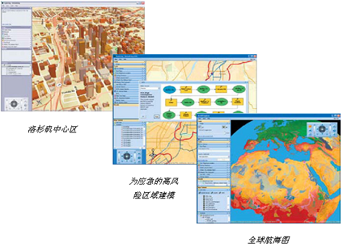
- 无缝的以2D和3D方式浏览整个世界的数据
- 集成本地数据以及来自ArcGIS for Server,ArcIMS的服务和数据,OGC WMS或ArcWeb Services
- 通过任务进行GIS分析,如可视化分析,建模,邻域查找和统计分析
- 以地图的方式回答跟地理相关的问题,并与他人共享你的结果
- 使用自有的服务器上的数据和地图,并与其他服务器上的数据联合使用

ArcGIS 10.2新特性全面来袭
-ArcGIS Online功能新突破,迈进真正云PaaS平台
-Portal for ArcGIS开启GIS应用新模式
-ArcGIS for Server具备大数据实时分析和处理能力
-ArcGIS移动产品重磅出击,支持离线编辑和分析
-桌面功能和性能全面提升,大数据支持能力彰显
-ArcGIS三维功能极大提升,与CityEngine深度集成
-影像数据支持显著增强,实现国产卫星影像的支持
-灵活多样的扩展能力和一体化的资源入口
Esri released the new version of AcrGIS 10.2. The new release promises ease of use, real-time data access, and integration with existing infrastructure. It allows people to more easily deploy web GIS—the key component for implementing GIS as a platform.
ArcGIS 10.2 extends the analytic functionality of GIS via ArcGIS Online. Advanced analysis tools have been added to ArcGIS Online for investigating geographic relationships, patterns, and trends within data. New tools in ArcGIS Online include overlay layers for combining two or more layers into one single layer; enhanced hot-spot analysis; and data enrichment resources to glean information about the people, places, and businesses in a specific area or drive time. Esri entitled every customer organisation that has ArcGIS for Desktop (Basic, Standard, or Advanced) to receive an ArcGIS Online subscription. This is done to ensure that ArcGIS for Desktop users have access to ArcGIS Online capabilities. The new release introduces a number of new technologies that enable the real-time collection and sharing of data with GIS. It includes ArcGIS GeoEvent Processor for Server, a new ArcGIS for Server extension that gives users the power to access live data streams. People can analyse and send processed results to other users or into other systems. This capability transforms GIS applications into powerful frontline decision tools, refining data quickly for consumption and enabling fast response in any situation.

ArcGIS 10.2 Issues Addressed List: this
About Ersi
When Esri was founded in 1969, we realized even then that geographic information system (GIS) technology could make a difference in society. Working with others who shared this passion, we were encouraged by the vast possibilities of GIS.
Today, our confidence in GIS is built on the belief that geography matters—it connects our many cultures and societies and influences our way of life. GIS leverages geographic insight to ensure better communication and collaboration.
As you explore our Web site, you’ll discover how our customers have obtained the geographic advantage by using Esri software to address social, economic, business, and environmental concerns at local, regional, national, and global scales. We hope you will be inspired to join the Esri community in using GIS to create a better world.
Name: ESRI ArcGIS Desktop
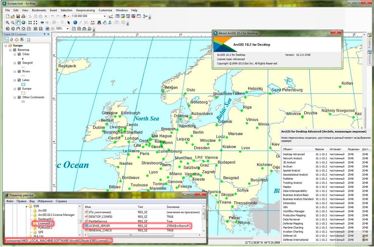
Version: 10.2.0.3348
Home: www.esri.com
Interface: english
OS: Windows XP / Vista / Seven
Size: 884.8 mb
Special Thanks LAVTeam
Download filefactory
http://www.filefactory.com/file/7i1lyag2luv/deares102.rar
Download 百度云
你是VIP 1个月(1 month)赞助会员,