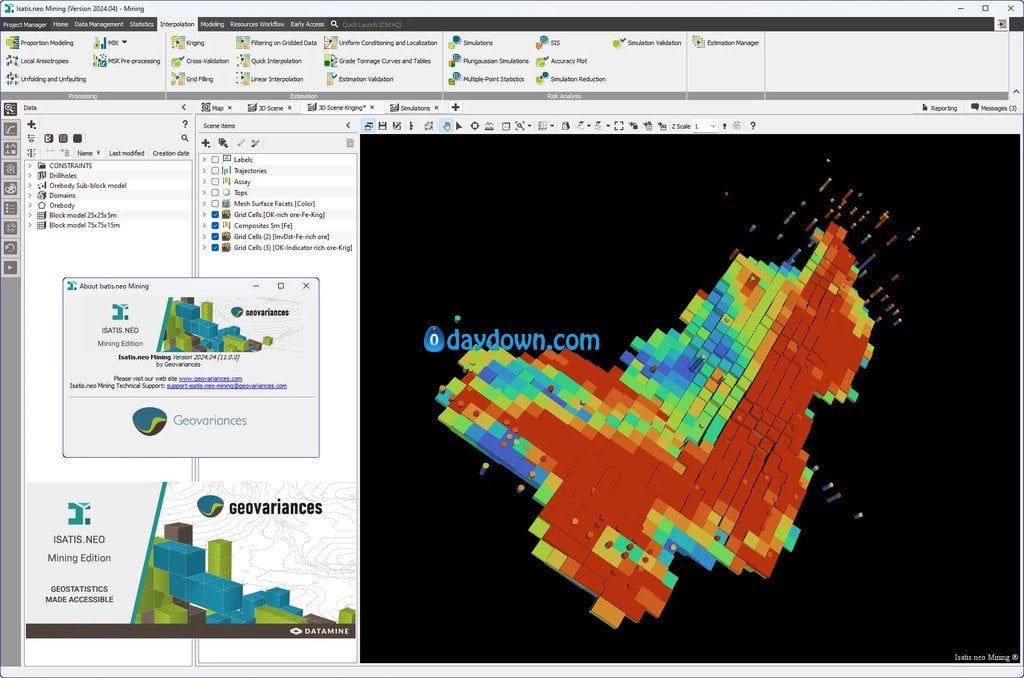
Geovariances has released ISATIS.NEO 2024.04. This release introduces a new kind of graphic to strenghten the validation of your simulation results. Additionally, it comes with new interfaces for exchanging data and objects between Isatis.neo projects and with other software, and provides enhanced Calculator performance.
What’s new in ISATIS.NEO 2024.04
Note: All the new features are available in the three editions of Isatis.neo, Standard, Mining, and Petroleum.
With the new accuracy plots, you’ll be able to check the model of local uncertainty. This new graphic compares the probability interval against the actual fraction of true values that are inside the probability interval.
– You can now conveniently exchange any data or objects between Isatis.neo projects using the available explorers, including neighborhoods, geostatistical sets, color scales, chart files, scenes, batch files, and files in the public folder.
– A new interface allows effortless import of Fusion boreholes by connecting Isatis.neo to the Fusion database.
– Export 3D grids and points to NetCDF files for easy reuse in QGis, ArcGISPro, or Paraview.
– Access the newest versions of pandas, numpy, and matplotlib with Python 3.11 and be compatible with Vulcan’s latest version.
– The lag slider has been optimized for an almost instant display of the recomputed variogram and associated model as you drag it.
– You can now quickly calculate quantiles on very large datasets, even on those that couldn’t fit in memory in previous versions.
– Benefit from improved Calculator performance for the “Per sample” mode that now uses native C++ instead of Python code for calculations.
– Now, you can quickly move a file from one folder to another by dragging and dropping it with the mouse.
– The PCA/MAF Backward Transformation functionality lets you save outputs as macro-variables.
ISATIS.NEO is the leading and most comprehensive software solution for geostatistics. Featuring an intuitive user interface, it results from Geovariances’ dual commitment to developing breakthrough technology and making premium geostatistics accessible to more users. Designed for every business dealing with spatialized data, Isatis.neo exceeds industry standards in geostatistics. The software enables thorough data analysis and visualization, produces high-quality maps and models, and allows you to carry out extensive uncertainty and risk analyses that optimize your decision-making process. Available in a Standard Edition, Isatis.neo is also offered in two special versions, Petroleum Edition and Mining Edition, to better meet the specific requirements of these two industries.
Founded in 1986, Geovariances is a French independent software vendor. Our solutions, based on sound and avant-guard state-of-the-art Geostatistics, respond to your problems related to mapping, resource estimation and risk analysis. Leader in geostatistics, Geovariances guarantees its clients the reliability and scientific rigor of its solutions thanks to an exclusive 30-year partnership with the Center of Geoscience of Mines ParisTech, the birth place of Geostatistics. Geovariances reliability also lies on the cooperation with partners all over the world.
Owner: Geovariances
Product Name: ISATIS.NEO
Version: Mining Edition 2024.04
Supported Architectures: x64
Website Home Page : http://www.geovariances.com
Languages Supported: english
System Requirements: Windows *
Size: 806.0 mb
转载请注明:0daytown » Geovariances ISATIS.NEO Mining Edition 2024.04
 Password/解压密码www.tbtos.com