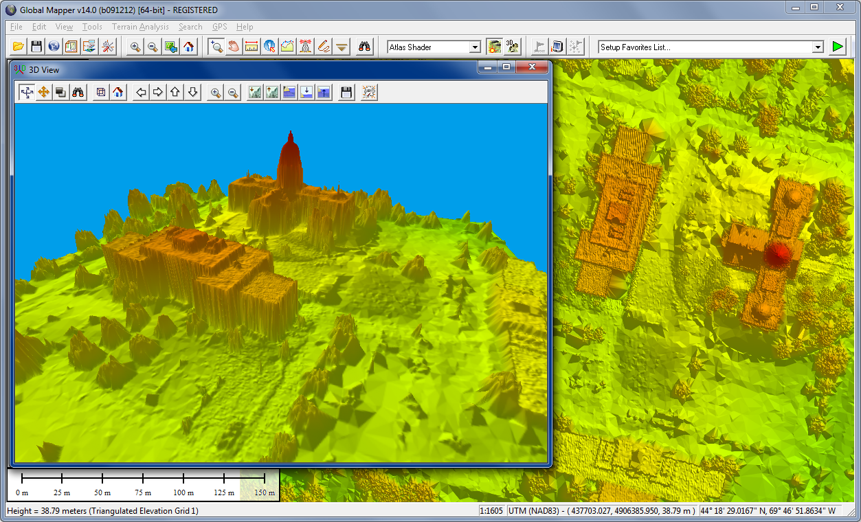
Global Mapper的用途
浏览、合成、输入、输出大部分流行的扫描点阵图、等高线、矢量数据集的软件,它可以编辑、转换、打印各类地图图形文件,可以利用全球情报系统(GIS) 信息资源。它可以转换数据集的投影方式以符合你的项目的坐标系统,并可以同时对数据集的范围进行裁剪。它还提供距离和面积计算,光栅混合、对比度调节、海拔高度查询、视线计算,以及一些高级功能,如图像校正、通过地表数据进行轮廓生成、通过地表数据观察分水岭、对3Dpoint数据转换为三角多边形和网格化等。通过内建的脚本语言或众多的批处理转换选项能够高效地完成重复性任务。
Global Mapper 17.x (x86/x64) | 122/121 Mb
Global Mapper is an affordable and easy-to-use GIS Data processing application that offers access to an unparalleled variety of spatial datasets and provides just the right level of GIS functionality to satisfy both experienced GIS professionals and mapping novices. Equally well suited as a standalone spatial data management tool and as an integral component of an enterprise-wide GIS, Global Mapper is a must-have for anyone who deals with maps or spatial data.
• Unmatched spatial data format support
• Low cost and easy-to-use
• Just the right level of GIS functionality
• Unmatched and complimentary support
Global Mapper is more than just a utility; it has built in functionality for distance and area calculations, raster blending, feathering, spectral analysis, elevation querying, line of sight calculations, cut-and-fill volume calculations, as well as advanced capabilities like image rectification, contour generation from surface data, view shed analysis, watershed delineation, sea level rise modeling, terrain layer comparison, and triangulation and gridding of 3D point data. Global Mapper 15, released September 18th features a ton of great new functionality and is the largest Global Mapper release to date.
Version 16 features include:
• A new advanced LiDAR Module for in-depth processing and analysis
• A new Extension Interface which allows 3rd-parties to create add-ons to Global Mapper to extend functionality through their own toolbars and/or menu items. This allows our users to get creative and share their technology with the greater Global Mapper community. Users will need a Global Mapper Software Developer Toolkit (SDK) in order to write their extension. Contact your sales representative for more information.
• New support for import and export of 3D PDF for easy communication of spatial information with non-GIS users.
• This release also features a powerful Raster Calculator that can perform mathematical calculations on multi-band imagery. Including built-in NDVI and NDWI calculations and support for custom formulas.
• Support has been added for passing variables to scripts on the command lines.
• An option to automatically download and/or load files/web links associated with an attribute of selected features has been added. This is a very powerful feature allowing users to easily download files associated with features (like coverage areas) from an online server or loaded from a local disk.
• Users can now also edit and re-calculate multiple view shed layers.
• For more features view the what’s new file in the help files.
Home Page – http://www.globalmapper.com
Download uploaded
http://uploaded.net/file/wzqv6hy3/Global.Mapper.v17.1.0.b020216-BEAN.zip
http://uploaded.net/file/teb0hbp4/Global.Mapper.v17.1.0.b020216.x64-BEAN.zip
Download nitroflare
http://nitroflare.com/view/DFF82CC706140F2/Global.Mapper.v17.1.0.b020216-BEAN.zip
http://nitroflare.com/view/0FE1E8D9FF0F503/Global.Mapper.v17.1.0.b020216.x64-BEAN.zip
Download 城通网盘
Global.Mapper.v17.1.0.b020216-BEAN.zip: http://www.t00y.com/file/143150930
Global.Mapper.v17.1.0.b020216.x64-BEAN.zip: http://www.t00y.com/file/143150876
Download 百度云
http://pan.baidu.com/s/1pJQeKMf