Published 7/2024
MP4 | Video: h264, 1280×720 | Audio: AAC, 44.1 KHz, 2 Ch
Language: English | Duration: 1h 32m | Size: 4.88 GB
Embark on an exciting journey into the world of ArcGIS Pro with our video course, “Exploring ArcGIS Pro.”
What you’ll learn
Students will demonstrate proficiency in accessing and utilizing various features and functionalities of the ArcGIS Pro interface, including the Home screen.
Students will be able to georeference raster images using control points accurately, ensuring spatial alignment and referencing to real-world coordinates.
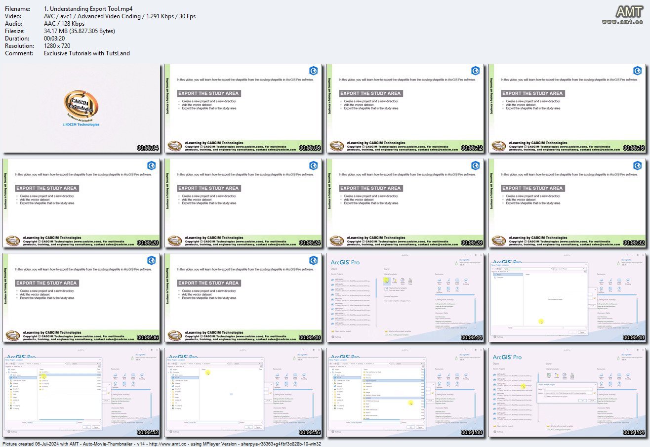
Students will demonstrate proficiency in using tools such as Export, Merge, Mosaic, Clip, and Extract by Mask to manipulate and export spatial data efficiently
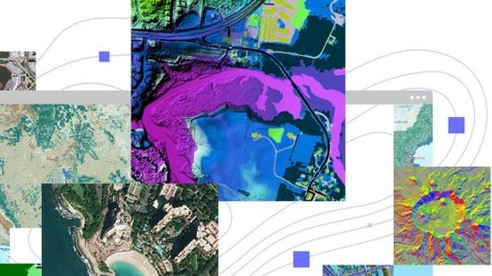
Students will be able to generate and interpret different types of maps, including slope maps, contour maps, and hillshade maps.
Requirements
Basic understanding of geographic information systems (GIS) concepts and terminology.
Foundational knowledge of GIS principles would likely enhance the learning experience.
Familiarity with basic GIS concepts such as spatial data types (vector vs. raster data), coordinate systems, projections, and georeferencing.
Understanding of file formats commonly used in GIS (e.g., shapefiles, raster formats like TIFF or JPEG).
Basic computer skills, including file management, navigation, and working with software applications
Knowledge of spatial analysis techniques (though not strictly required for an introductory course, it could be beneficial).
Understanding of basic cartographic principles such as symbology, labeling, and map layout (again, not strictly required but helpful for comprehending the visualization aspects of GIS).
Description
Embark on an exciting journey into the world of ArcGIS Pro with our video course, “Mastering ArcGIS Pro.” This course is designed for everyone, from beginners to experienced GIS professionals, and covers everything from the basics to advanced geospatial analysis.Start by exploring the ArcGIS Home Screen and learn how to create a new project step by step. Understand the project interface to efficiently organize and manage geospatial data within the ArcGIS Pro environment. Dive into geoferencing to align raster images with real-world coordinates using control points.Test your skills with practical evaluations and move on to explore various tools for geospatial analysis. Gain hands-on experience with the Export Tool, where you’ll convert and export shapefiles. Learn about merging, mosaic raster, clip, and extract by mask tools through real-world scenarios.Throughout the course, assess your progress with tests and gain insights into exporting geospatial files in different formats. Explore effective data management using tools like Dissolve, Union, and Intersect for shapefile management and integration.Delve into elevation data in both 2D and 3D environments, covering contours, contour maps, hillshade, and slope for terrain analysis.Explore land cover analysis with different indices like NDVI, NDBI, and MNDWI, applying mathematical formulations and tools for calculation.By the end of this course, you’ll have a strong skill set in utilizing ArcGIS Pro for geospatial analysis and data manipulation across various applications. Whether you’re a beginner or an experienced GIS professional, this course provides the knowledge and practical skills to excel in the world of geospatial technology.
Password/解压密码www.tbtos.com
转载请注明:0daytown » Exploring ArcGIS Pro 2024